
Love legend of Okinawa: A place for making connections




There are many areas in Okinawa where stories about men and women remain, such as the myth of the origin of humankind and the legend of Amami Kiyō, the founder of Ryukyu. We will introduce happy spots where you can feel the power of nature in Okinawa and where the power of the two of you in love can be increased.

- Use the map code feature on your car navigation system! Just enter the code number, and the navigation system will do the rest! It will guide you to your destination.
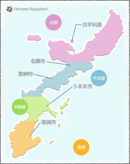
Northern Area
Kouri Island (Nakijin Village)
Kouri Island, also known as Ko-shima, has had legends of men and women since ancient times.
The Okinawa version of the Adam and Eve legend
Address: Kuguori Village, Ichinoseki Town, Kunigami District, Okinawa Prefecture
- Map code
- 485 751 179*57
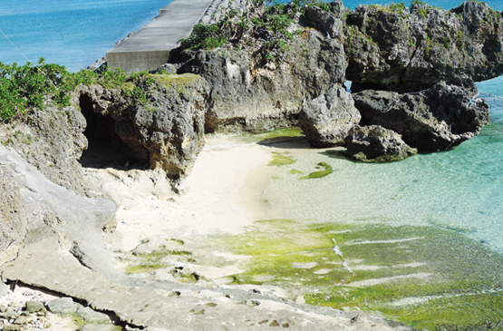
Kouri Island is called “Love Island,” and the legend of the “Okinawa version of Adam and Eve,” the myth of the origin of humankind, remains. In front of Shirasa Cape, where God first landed, a monument to the island where humankind originated has been erected.
Hartlock Kouri Island
Address: Kuguori Village, Ichinoseki Town, Kunigami District, Okinawa Prefecture
- Map code
- 485 751 179*57
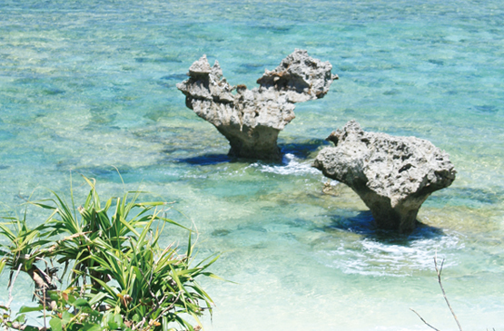
A spot that's been making headlines in the Aiza commercials...!! Two rocks that have been joined together at Teinu Beach on Kouri Island create a beautiful heart-shaped formation that's popular with couples. Swimming in Teinu Beach is also enjoyable, and the heart-shaped rock reflected in the sunset is also romantic.
The Okinawa version of the Adam and Eve legend
Long ago, two children, a boy and a girl, descended from the sky from the sky on the island of Kujuri. They were completely naked and lived happily eating the rice cakes that fell from the sky every day. At first, the two of them had no doubts about it, but one day a worry arose that they would run out of rice cakes, so they started to save them little by little. Soon, the rice cakes stopped falling. The two of them sang and prayed to the sky until they were unable to make out the sound of their voices, but the rice cakes never fell again. Out of desperation, the two descend to the beach and become skilled in catching fish and shellfish every day, learning the hardships of life and labor. One day, they encounter a jellyfish in the sea. Aware of the difference between male and female in seeing jellyfish mating in the sea, the two of them became ashamed of being naked, so they began to hide their private parts with bamboo leaves. It is said that after that, two of their descendants grew in number and became the ancestors of the people of Okinawa.
Central and Northern Area
Nago City
There are legendary spots in the northern city of Nago City too!
Hotsuda's hand-washing basin
Address: 211 Kyoda, Nago City, Okinawa
- Map code
- 206 446 608*21
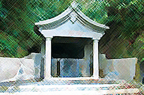
This is Higagawa, the stage for one of the performances of Okinawa’s classical performing arts, the “Komiyo-do” (Group Dance). Young men and women from all over the country come to Yotsuda to seek the fulfillment of their destiny, and Yotsuda’s legend of the well of Yotsuda has become famous.
The legend of Hoshida's handwashing
Long ago, there was a young samurai on a journey from Sukorai to Yanbaru. As I approached Hoshida, I got thirsty and asked the people along the way if there was a well somewhere. They told me that there was a stream under the nearby forest. I hurried to the stream and found a beautiful village girl drinking water. The attendant couldn’t help but ask, “My dear daughter, could you please get some water from that hand and give it to me to drink?” He asked the stranger, who didn’t know who he was, to get the water with his hand... The girl reddened her face and refused. The young samurai still couldn’t give up and kept asking over and over again. Eventually, the daughter, shyly, handed the water from Higagawa to the samurai. Even after returning to Sukorai, the samurai could not forget about the daughter of the water from Yotsuda, and it is said that he finally brought the daughter to Sukorai and married her.
Central and Northern Area
Onna Village
The legendary spot is also located on the west coast, Okinawa's premier resort area!
Red rope knot
Address: Okinawa Kariyushi Beach Resort Ocean Spa premises
- Map code
- 206 381 655*54
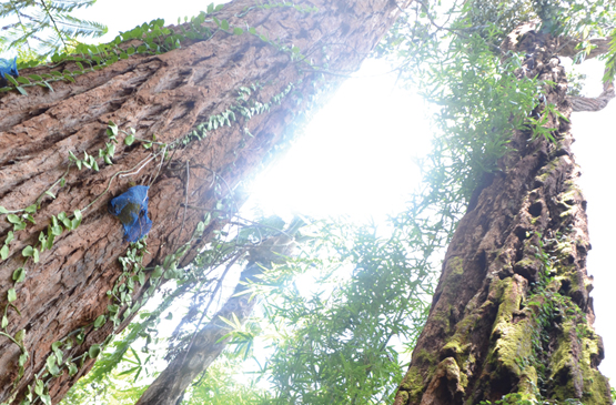
In a section of the forest at Kariyushi Beach in Onna Village, there is a legend of a red rope (aka-jino no mokuroku) that only grows in this forest. The two trees have a mysterious appearance that seems like a man and a woman are embracing each other. This is a spot recommended for those with good physical condition because the mountain path is steep.
The legend of Akitsugu
Once upon a time, a young man was traveling and was looking for a place to spend the night. He noticed two red trees nearby. Curious, he approached them and saw a gray-haired old man sitting between the trees, intently tying a rope. When he asked what he was doing, the old man replied, "People are born with a predetermined arrangement for a couple, and to ensure that those two people will meet each other properly, they tie their left ankles together with a red rope." The young man asked if his left ankle was also tied with a red rope. The old man pointed to a woman with a shabby, impoverished appearance who was approaching from behind and said, "That's my daughter." Upon hearing this, the young man's attendant was furious and slashed her back with a sword, sending her flying into the river. Four years later, the young man diligently studied in Shuri and became the civil servant he had long dreamed of, achieving success in his career. One day, while walking down the mountain path to return to Yamahara’s hometown, I injured my leg and was unable to walk. Fortunately, I was rescued by a wealthy couple who passed by there. We ended up staying at their house. We fell in love with the beautiful daughter who lived there and asked to marry her, but she hesitated because she said, “There is an ugly big scar on her back.” In fact, that daughter was the woman who was beheaded by a young court eunuch four years earlier. After being stabbed with a sword, she was in a critical condition and was being carried by the wealthy couple to the river. She was rescued by the wealthy couple and became their adopted daughter. When the young man remembered the old man's words, he said, "This is the girl I was tied to with the red rope. Isn't this the wound I cut? From now on, I intend to cherish this person for the rest of my life, repaying my debt." He vowed in his heart and hugged the girl, shedding tears. Even the daughter who doesn't know this is crying with tears of joy, saying, "How could you marry someone like me with such ugly scars on my back?" After that, the two people prayed to the mysterious two trees, cared for each other, and lived happily together out of mutual affection.
Central and Southern Area
Uruma City
Ahead of the Sea Road are the power spots of mysterious islands
Fukurobanta
Address: 2768 Yonashiro Miyagi, Uruma City, Okinawa
- Map code
- 499 674 644*01
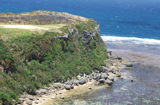
Just before Ieki Island, there is a cape called Fukubo (good things = happiness) Banata (a cliff) in front of the garden of the salt-making factory Nuchu-Nana in Miyagi Island. The breathtaking view of Nuchino Beach, where sea turtles come to lay their eggs, stretches out below. It is also popular as a spot for proposing marriage.
Amami-tutu
Address: Kasenbika, Uruma City
- Map code
- 499 551 365*85
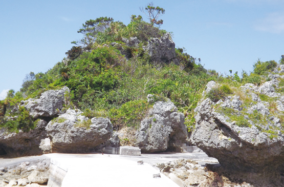
On the eastern coast of Hamabigashima there is a small island called Amazin that juts out into the sea. It is said that the ancestral gods Amami-tutu and Sirmi-tutu, the creators of Ryukyu culture, are enshrined here, and even today, prayers for fertility, good health, and the prosperity of offspring are offered at the beginning of each year.
Silmitsu
Address: 1606-9 Katsuren Higa, Uruma City, Okinawa
- Map code
- 499 490 879*14
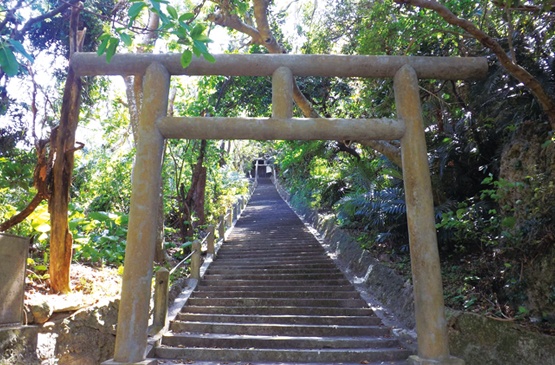
Also in the forest south-southeast of Hamabigashima, on the 108th floor, there is a limestone cave believed to be the residence of Amami-tuyu and Silmi-tuyu. Within the cave there is a limestone formation called yinshi, which is revered as a sacred stone for fertility.
The Ryukyu opening legend
In the Heavenly City there was a god named Amami. The Heavenly Lord called Amami and ordered him to descend to the lower world and build an island. Although there was land on the surface, it was not yet an island because the waves of the East and West Seas were constantly pushing against it. Amami-ku climbed to the sky and received from the Sky Lord the soil, stones, grass, and trees to build an island on the ground. Then, as time passes and no more people are born, Amami-ku returns to the heavens and asks the Sky Emperor for the seeds of human beings. The god Tencai bestowed the children, Amami-tutu and Silmi-tutu, to Amami-ku. The goddess was carried by a blowing wind and saw three men and two women. The eldest son became the king of Ryukyu as the Tenno clan, the second son became the beginning of the Anshi (local leaders), and the third son became the beginning of the peasants. The eldest daughter became the beginning of the Great Goddess (the goddess of the country), and the second daughter became the beginning of the Goddess of Fortune (the goddess of the local region).
Southern Area
Nanjo City
The entire area is a mystical power spot
Kudakajima
Address: A small island with a circumference of 7.75 km located approximately 5 km east of the Kinpo Peninsula
20 minutes by boat from Anza-Kamata Port
- Map code
- 1076 241 048*73
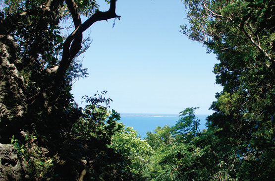
Kudakajima, considered a sacred place leading to Nirai Kanai, is a sacred island where religious ceremonies were held during the Ryukyu Dynasty, and is said to be the birthplace of the five grains. There are places and customs on the island that are off-limits to visitors, so caution is required when visiting.
Mintungsk Yaharazuka-sa
Address: Tamagusuku Chonemura Canal, Nanjo City
- Map code
- 232 500 847*53
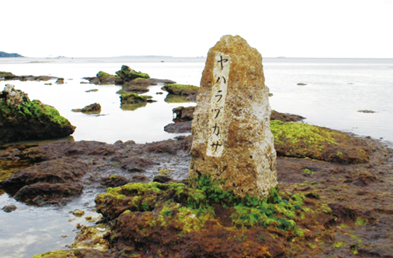
Yahara-zukasa is said to be the place where Amami-kiyo, who crossed from Kujokishima to the main island, landed, and a stone monument has been erected. During high tide, Amami-kiyo disappears into the sea and becomes invisible, and during low tide, its full glory is revealed. Amami-kiyo is said to have built a castle in a hill area at an elevation of 110 meters and settled there. The castle ruins are known as Mintung Castle.
Sefa-utaki
Address: Nanjo City, Kinoya Kujiki
- Map code
- 33 024 282*64
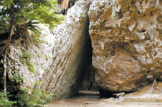
Utaki is the collective term for sacred places where rituals and other religious activities are performed in Ryukyuan religion. Seifu means the highest level of that place. As you proceed along the most famous shrine path, Sanguui, you can see Kujokishima Island on the other side of the sea.
A bridge to happiness at Konin Cape Park
Address: Nanjo City, Kinoya Kujiki
- Map code
- 232 594 532*68
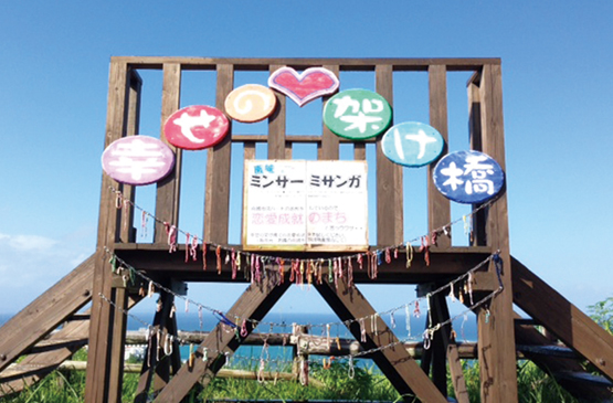
Behind the entrance to the park, "Shichijo Station Nanjo" has installed a "Bridge of Happiness." It is a breathtaking spot overlooking the Pacific Ocean. According to legend, if you spread your hands on this bridge between "Sajabako-no-taki" and "Kukokajima," you will receive power and become happy.

A breathtaking panorama that you definitely want to stop by on your sightseeing trip!
-
Kienpo Beach Park
Address: Nanjo City, Kinoya Kujiki
- Map code
- 232 594 503*64
This is a breathtaking spot where the beautiful Pacific Ocean stretches out before your eyes. This is a park that is not well known to many people except those from the local area, but it is conveniently located at the back of the Chinen Gymnasium, and it has parking, a walking path, and a snack bar, so it is highly recommended.
-
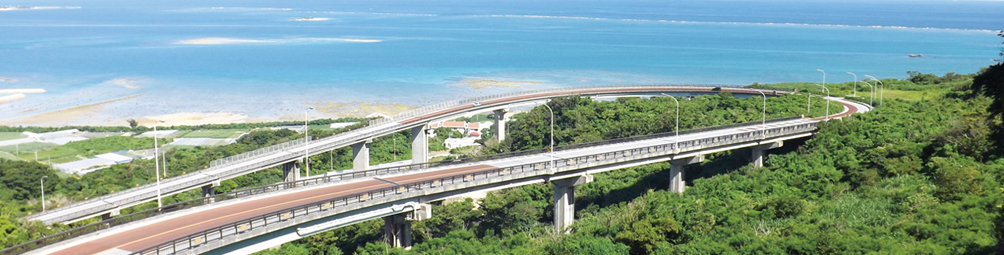
Nirai Kanai Bridge
Address: Chinen, Nanjo City
- Map code
- 232 593 248*63
As you drive along National Route 331, you’ll see a bridge that spans over the mountain side. It’s called the Niraikan Bridge, and it’s a breathtaking spot where you can see the sea from both the Nira Bridge and the Kana Bridge!
